TTT 6 - 2015.
After Trek the Trak 5 in 2014 pushed us to new boundaries and reinforced the value of the Flying Doctors, the trek for 2015 was always going to be hard to choose. For a couple of years a plan has been brewing away, like a nice beer of choice, in the back of the minds of the brains trust: "wouldn't it be great to go from one side of Australia to the other".
Well, 2015 its happening. Its happening now.
Mainland Australia is about 4000 kilometres wide, as the crow flies. Steep Point is the westernmost point. It is about 1000 kilometres north of Perth. It is located within the Shark Bay World heritage site in the Gascoyne region of Western Australia in the waters of the Indian Ocean. The nearest town is Denham. Access is by four wheel drive vehicle or suitable motorbike.
Cape Byron is the easternmost point of mainland Australia. It is located about 3 kilometres northeast of the town of Byron Bay and projects into the Pacific Ocean. The cape was named by pommie explorer Captain James Cook, when he passed the area in May 1770, to honour British explorer John Byron who circumnavigated the globe in the HMS Dolphin from 1764 to 1766.
This journey was first undertaken by latter day explorers, adventurers and TV personalities Mike and Mal Leyland. Their trip began on May 3rd, 1966 and finished on August 20th of the same year. In total they had 111 days of travel, covering 4248 miles (6836.5 kilometres), following a similar course to the one we will take, although they went to Uluru, which we will go north of. Their aim was to largely follow the 26th parallel, following roads such as the Gun Barrel Highway which old mate Len Beadell had pushed through only 8 years earlier.. They too had a crossing of the Simpson desert, taking 22 days to cover largely uncharted territory at that time. The Leyland Brothers had a 1963 petrol Land Rover Hard top, a 1958 petrol Land Rover Station Wagon, a Bridgestone 90 Mountaineer motorcycle, a heavy duty (very heavy!) 4 wheel trailer and no roof racks, no gps, no factory sponsorship and no prize money.
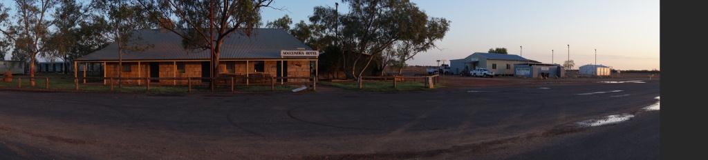
The itinerary was to travel east from Steep Point through West Oz to Meekatharra, Warburton then Giles, tracing parts of the old Gunbarrel Highway.. We then turn northerly, picking up the Sandy Blight Junction Road, then east again along the Kiwirrkurra Rd (old Gary Junction Road) into Alice Springs. From the Alice we will turn south east, down to the Simpson Desert, which we will cross and go into Birdsville. From Birdsville we had no real plan other than get to Byron Bay in about four days.
After Trek the Trak 5 in 2014 pushed us to new boundaries and reinforced the value of the Flying Doctors, the trek for 2015 was always going to be hard to choose. For a couple of years a plan has been brewing away, like a nice beer of choice, in the back of the minds of the brains trust: "wouldn't it be great to go from one side of Australia to the other".
Well, 2015 its happening. Its happening now.
Mainland Australia is about 4000 kilometres wide, as the crow flies. Steep Point is the westernmost point. It is about 1000 kilometres north of Perth. It is located within the Shark Bay World heritage site in the Gascoyne region of Western Australia in the waters of the Indian Ocean. The nearest town is Denham. Access is by four wheel drive vehicle or suitable motorbike.
Cape Byron is the easternmost point of mainland Australia. It is located about 3 kilometres northeast of the town of Byron Bay and projects into the Pacific Ocean. The cape was named by pommie explorer Captain James Cook, when he passed the area in May 1770, to honour British explorer John Byron who circumnavigated the globe in the HMS Dolphin from 1764 to 1766.
This journey was first undertaken by latter day explorers, adventurers and TV personalities Mike and Mal Leyland. Their trip began on May 3rd, 1966 and finished on August 20th of the same year. In total they had 111 days of travel, covering 4248 miles (6836.5 kilometres), following a similar course to the one we will take, although they went to Uluru, which we will go north of. Their aim was to largely follow the 26th parallel, following roads such as the Gun Barrel Highway which old mate Len Beadell had pushed through only 8 years earlier.. They too had a crossing of the Simpson desert, taking 22 days to cover largely uncharted territory at that time. The Leyland Brothers had a 1963 petrol Land Rover Hard top, a 1958 petrol Land Rover Station Wagon, a Bridgestone 90 Mountaineer motorcycle, a heavy duty (very heavy!) 4 wheel trailer and no roof racks, no gps, no factory sponsorship and no prize money.
The itinerary was to travel east from Steep Point through West Oz to Meekatharra, Warburton then Giles, tracing parts of the old Gunbarrel Highway.. We then turn northerly, picking up the Sandy Blight Junction Road, then east again along the Kiwirrkurra Rd (old Gary Junction Road) into Alice Springs. From the Alice we will turn south east, down to the Simpson Desert, which we will cross and go into Birdsville. From Birdsville we had no real plan other than get to Byron Bay in about four days.